

As you well know by now, we could not find last week’s Mystery Monday resulting in Mystery Friday. So, here’s what happened.
Typically I’ll notice an interesting photo and forward it Sam, who then files it away for a future Mystery Monday post. The only concrete information we have on the photo at first is the date it was taken, and the County and State it is located in. Then sometime later in the week, we utilize some tools that we have, and narrow down the photos precise location. So we did that… and failed.
And that’s what these next couple of posts are really about. Giving you the same tools we have to find the location of this mysterious photo. Why do this when we’ve already spent hours looking? Because we don’t know everything. Time and time again you guys amaze us with your vast knowledge of the surrounding terrain, architectural style, and other fantastic observations. And as we always mention in our Mystery Monday posts, it’s estimated that 40% of our photos document places that are no longer standing. So maybe one you lives where this photo is located and remember when it was still standing.
Alright, so here’s what we know about the photo:
The photo was taken in 1964 and is located somewhere in Beaver County, PA.
Thankfully, we also have a flight map that goes along with the film. It looks like this.
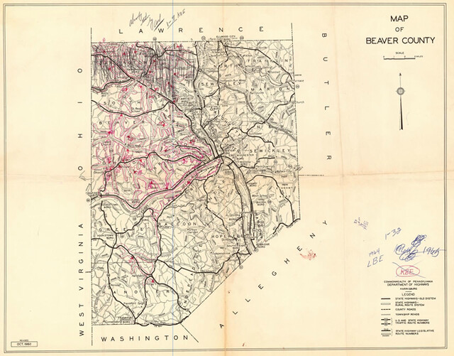
See all of those red lines? Those are the flight paths that the pilot took. Each one is numbered and corresponds with its matching roll. The photo is located on roll 28, so here’s a close up on that roll on the map…
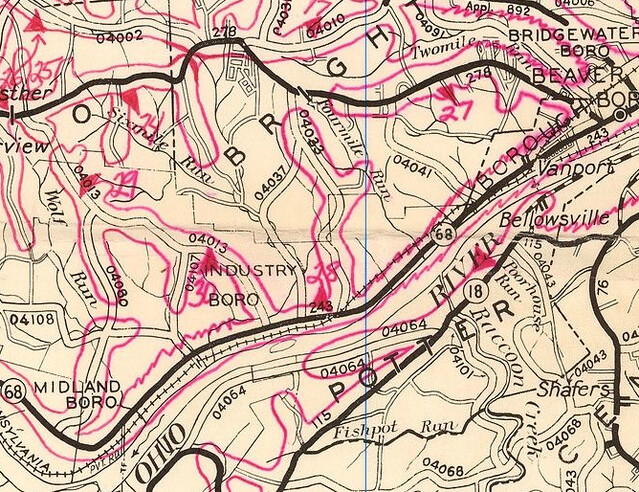
As you can see, it seems that the roll starts north of and along Highway 68 and the Ohio River and then goes north into Industry, PA.
Now, you have the year the photo was taken, what county/state it’s in, and the possible roads around it. So, get to work!
Later this week, I’ll share another very important tool we use. And trust me, you won’t want to miss it!
Visitor Comments
I'm stumped. You could try contacting the historical societies in Beaver County and send them the picture; maybe someone would recognize the house? Maybe it was located where they've put through the Beaver Valley Expressway? It seems like the kind of building someone would want to at least renovate and reuse to some new purpose rather than just demolish, though.
I look forward to learning the answer, when you finally find it!
Don't think we will find it by map.....I have carefully followed flight plan and beyond....looking for the stand of pines also...house and landscape just not there ....neither is rock building. Going to have to find it due to description found, or as Gretchen has suggested.
Hold tight... more tools coming soon!