

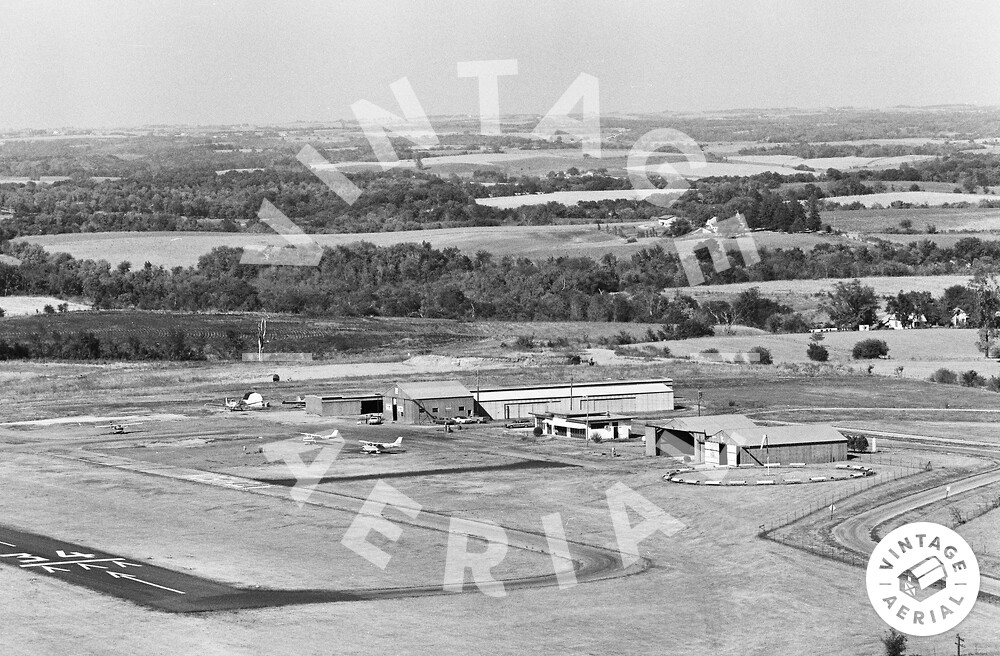
Welcome back to another Mystery Monday contest! Every Monday, we’re going to post a photo from our collection and invite anyone to guess its location. The first person to correctly identify the location will win a prize. To start the year, we’ll be giving the winner a $50 gift certificate towards a framed photograph.
Here are the guidelines for the contest:
- If you can correctly identify the photo with a link to Google Maps showing where it is, or should be, you win! Leave a comment here on the blog or on our Facebook Page.
- Whoever identifies the photograph and posts a link to its correct location first, wins!
- This week’s winner will receive a $50 coupon for any framed print, or simple bragging rights! Whichever you prefer!
- In order to win, the photo’s location must be correctly identified by this Friday at 5:30PM EST.
If you know of anyone else who would enjoy this blog (or perhaps someone who would be a great competitor,) please send them here!
Let the games begin!
Visitor Comments
I'm gonna take a wild guess that this is an airport :-)
It's probably somewhere between the Appalachians and the Rockies (actually, probably not any further west than 98W).
Amelia Earhart Airport (designation K59) in Atchison, Atchison County, Kansas. Google maps link: http://maps.google.com/maps?hl=en&...
My SWAG ... Pontiac, Illinois Old Airport ...???
Since Randy has revealed the location, I can now admit I noted this airport was partially visible in one of the Mystery Monday photos from last October: see my comments at http://vintageaerial.com/blog/2011/10...
Well done! Had I viewed the photo two days ago, I would have gotten it too. I've been there for Amelia Earhart Days in Atchison.
From Tony's comments, "Lance's hint last week about how to see all the rolls available for a given county." -- how does one go about doing that??
Thanks
After the http vintageaerial.com part (writing it this way so it isn't automatically turned into a link), it's: photos/state/county/rolls (where state and county are all lower case, and any spaces are replaced by dashes). For example, to see all the rolls available for Cape May County, New Jersey: http://vintageaerial.com/photos/new-j...
That page shows that Vintage Aerial owns several rolls taken in 1989, but that only two of them (18,19) have been scanned so far.