

Join Our Community
33,560 members are helping us to bring our collection to life.
Create a free Vintage Aerial account now to start commenting on photos, pinning locations, and earning points redeemable for our products!
Sign up now and receive a coupon for 10% off your first order!
Comments
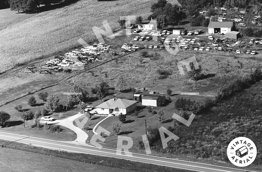
My Family and I lived at this house from 1954 through about 1974 when my mom sold it to the ever increasing junk yard behind us. The address then was RR1 West Point, IN. Then it later changed to 5606 SR 25W, West Point, IN 47992.
Then it got sold again and the newer owners burned it down about 2021. The Google Earth GPS for the center of this house (it's still on google earth as a 2018 image as of 13 Dec 2023) is : 40 degrees, 20 minutes, 10.65 seconds North by 87 degrees, 03 minutes, 22.01 seconds West.
OR, Digitally: 40.336292, -87.056114
The Driveway entrance was at : 40 deg, 20 min, 10.31 sec by 87 deg 03 min 20.21 sec
-OR-
40.336197, -87.055614
Hi there! Thank you for sharing your memories of the house in Tippecanoe County. It sounds like there have been quite a few changes to the property over the years. Can you tell us more about your experience growing up in the area during the time the photo was taken in 1966? We'd love to hear more about what the neighborhood was like back then. Also, did your family engage in any farming activities on the property?