

Join Our Community
33,551 members are helping us to bring our collection to life.
Create a free Vintage Aerial account now to start commenting on photos, pinning locations, and earning points redeemable for our products!
Sign up now and receive a coupon for 10% off your first order!
Comments
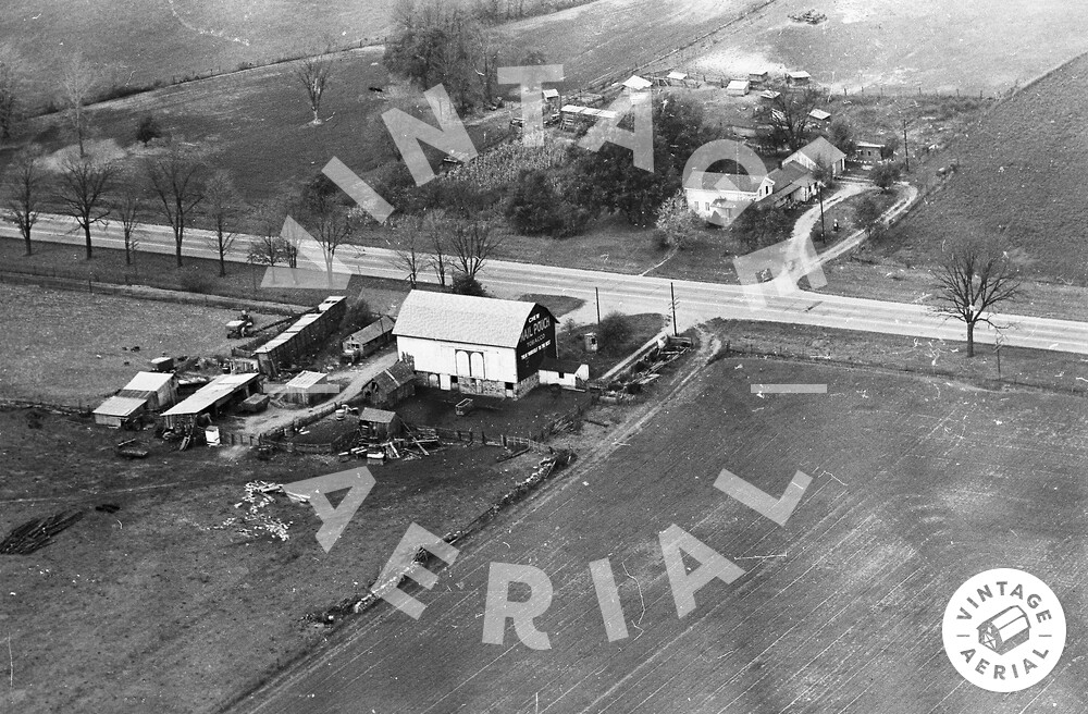
The pin on the map is the approximate location of the Mail Pouch barn in the photo above. Historic Aerials’ imagery was used to determine the location of the barn. The Mail Pouch barn, the other buildings (both sides of W. Chicago Rd.), and the site configuration including the looped driveway on the northwest side of the road are clearly visible in imagery beginning in 1955. The 1955 & 1958 images are configured in a way that notes that the Mail Pouch sign was not on the northeast end of the barn at that time, so the sign was probably painted early 1960’s for it to be in the 1963 Photo. The available imagery shows that by 2005 the barn and all the buildings on the southeast side of Chicago Rd. were gone and the site cleared. Subsequent imagery shows a gradual clearance of the buildings on the northwest side of Chicago Rd.until 2016 when that side of the road is completely cleared. The Mail Pouch barn is ID'd as MPB 22-12-08 on the Mail Pouch Barnstormer's website.