

gone
We found 190 results for your search in 1.41 seconds:

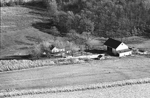
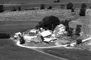
79-LFR-15
1967
98
gone (including house at the top of the photo). House still stands and a couple

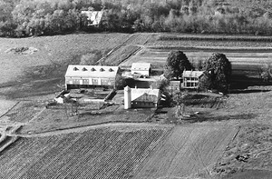
79-LFR-14
1967
114
buildings to the left of the road are gone. House still stands and a couple outbuildings.
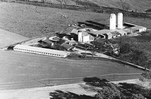
79-LFR-34
1967
97
address. 39.34180, -77.25084 are the house coordinates. Nothing left of this farm. Gone by the mid-eighties to development.
56-NFR-6
1971
41
gone, to be developed. Walkersville Elementary School sits in front of this location. See, also

56-NFR-4
1971
34
gone, to be developed. Walkersville Elementary School sits in front of this location. See, also
56-NFR-31
1971
27
gone. Would have been a Catoctin Mountain Highway address. Monocacy Blvd. is just to the left
56-NFR-30
1971
30
gone. Would have been a Catoctin Mountain Highway address. Monocacy Blvd. is just to the top of the photo

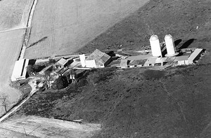
4-NFR-34
1971
52
12505 Renner Rd., Keymar. Large barn is gone.
14-MFR-7
1974
53
11128 Repp Rd., Union Bridge. Large barn and house are gone.
13-MFR-35
1974
77
gone.
10846B Clemsonville Rd., Union Bridge. Lehigh Cement owned the property for years and will
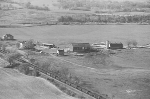
131-EEFR-6
1988
59
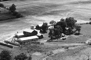
gone. B&O Railroad tracks at the bottom left, with I-270 in the background
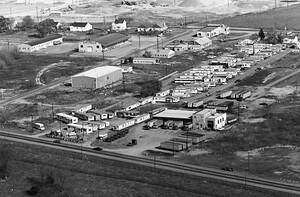
74-LFR-11
1967
180
gone. B&O Railroad tracks at the bottom left, with I-270 in the background
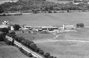
107-LFR-5
1979
35
photo are gone. B&O Railroad tracks at the bottom left, I-270 at the top.

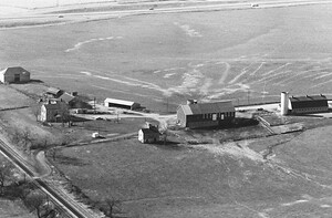
74-LFR-1
1967
115
Farm totally gone. Kroger Fulfillment Center at 7106 Geoffrey Way, Frederick, sits right there now.
74-LFR-7
1967
139
gone and most of the center left of Grove Rd. is Younger Nissan of Frederick

74-LFR-3
1967
87
couple outbuildings. All else has gone to development. Buckeystown Pike (MD-85) in the foreground.

74-LFR-5
1967
92
gone. Francis Scott Key Mall now occupies this land. House coordinates would have been, 39.38253, -77.40692. About

74-LFR-33
1967
46
912A Greenfield Rd., Dickerson. Large barn and silo are gone. Same farm in photo #31.

74-LFR-31
1967
49
912A Greenfield Rd., Dickerson. Large barn and silo are gone. Same farm in photo #33.

74-LFR-34
1967
45
farm is gone. House coordinates were 39.26251, -77.43980. Some remnants of the barns are evident still.

119-LFR-5
1979
11
complex was. All of this is gone. House coordinates were 39.35227, -77.41564. See, also, photo #4 & #6.

119-LFR-4
1979
12
complex was. All of this is gone. House coordinates were 39.35227, -77.41564. See, also, photo #5 & #6.

119-LFR-6
1979
15
complex was. All of this is gone. House coordinates were 39.35227, -77.41564. See, also, photos #4 & #5.

119-LFR-7
1979
10
gone and replaced by ATSM International at 4441 Buckeystown Pike, Frederick. The house coordinates were