

farm
We found 289 results for your search in 0.99 seconds:
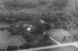
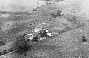
26-OWA-32
1968
146
farm was located in the vicinity of 620 N Main Street (OH-741) and was across
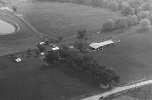
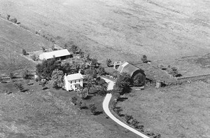
26-OWA-33
1968
146
This farm occupied the land approximately where Dorthy Lane Market on N Main currently sits.
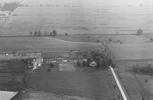
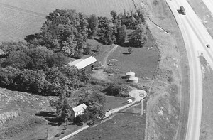
26-OWA-35
1968
142
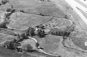
farm sat about 550 feet southeast of the Dayton Wright Brothers airport runway (the portion

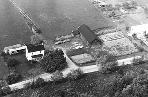
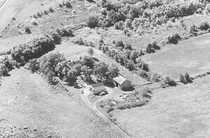
27-OWA-3
1968
139
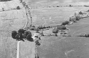
Farms, annexed to the City of Springboro circa 1967. The house was located almost due west

27-OWA-5
1968
145
Franklin Rd. The farm was built in 1958 and looks much the same as it did then.
27-OWA-9
1968
107
Senior Living Springboro now sits (8683 Clearcreek Franklin Rd), this farm was gone by 1993.

27-OWA-11
1968
106
approximately at 536 OH-73), this farm was gone by 1986, replaced by commercial building.
27-OWA-27
1968
93
farm was located at the northeast corner of Factory Rd and Beck Dr. It is now occupied

27-OWA-34
1968
86
farm was located on the east side of Hazel Woods Park. It was torn down

27-OWA-35
1968
102
farm buildings (south of W Lower Springboro Rd) were torn down after October 2006. The barns

27-OWA-36
1968
98
farm buildings (south of W Lower Springboro Rd) were torn down after October 2006. The barns

29-OWA-16
1968
70
farm was located at 4320/4340 Beal Rd and has been gone for decades. I traced

29-OWA-18
1968
68
farm lied between the Motley farm and Montgomery farm
This farm, long razed, was built

29-OWA-21
1968
111
pete motley farm

29-OWA-22
1968
127
bob scholl farm

29-OWA-30
1968
68
Henderson Turf Farm located at 2969 Beal Rd.
30-OWA-3
1968
95
farm was located at ~3711 State Route 741 and was razed circa 2002. The house

30-OWA-16
1968
78
farm across the street is 5210 N. Dearth Rd. Both plots of land trace back

30-OWA-38
1968
63
Route 123. This is a different angle of the farm in picture 36:
https://vintageaerial.com/photos/ohio/warren/1968/OWA/30/36
31-OWA-12
1968
87
farm was razed in the late 80's and the first iteration of golf appeared

31-OWA-14
1968
84
farm was absorbed by Clearcreek @ The Practice Center by mid-2000. You can still still
31-OWA-16
1968
77
farm buildings were located approximately 400 feet south of 440 Watkins Glen Dr. The land
31-OWA-19
1968
115
farm sat southwest of 150 Graham Drive which was their bakery, known as The Bake
31-OWA-20
1968
78
farm buildings were located between the buildings at 200 and 301 Shotwell Dr. The farm